A Seaside Paradise owned by Filipino-American Retirees(David Balleza Katague & Macrine Nieva Jambalos)Boac,Marinduque, Philippines
WELCOME TO CHATEAU DU MER BEACH RESORT
If this is your first time in my site, welcome! Chateau Du Mer is a beach house and a Conference Hall. The beach house could now accommodate 10 guests, six in the main floor and four in the first floor( air conditioned room). In addition, you can now reserve your vacation dates ahead and pay the rental fees via PayPal. I hope to see you soon in Marinduque- Home of the Morions and Heart of the Philippines. The photo above was taken during our first Garden Wedding ceremony at The Chateau Du Mer Gardens. I have also posted my favorite Filipino and American dishes and recipes in this site. Some of the photos and videos on this site, I do not own, but I have no intention on the infringement of your copyrights!
Marinduque Mainland from Tres Reyes Islands
View of Marinduque Mainland from Tres Reyes Islands-Click on photo to link to Marinduque Awaits You
The first day of the 2011 Marinduque International Mission of Love ( 7th) started with more than 1000 patients lining outside the public court of the Gasan Municipal Court as early as 7:30AM. Later on the day another 500 more indigents were willing to wait for 3 to 4 hours before one of our 7 physicians and 20 nurses as well as about 25 pharmacists and another 50 support personnel missioners( crowd control, registrations, statistics, reporters etc) from US and Canada were able to serve their medical needs and avail themselves with the free medicines, vitamens, etc..during this first day of our 7th medical mission to my poor but beautiful island of Marinduque.
Simultaneously, hospital operations at the Boac Provincial Hospital ( both minor and major surgical operations as well as ophthalmic surgery operations) also had a chaotic start. As expected the first 4 hours of hospital operations was chaotic. But later on the late afternoon, about 45 minor surgeries and 25 ophthalmic surgeries were performed. Special thanks to our two outpatient surgeons, Dr. Al Manahan from Dallas, Teaxs and Dr. Mendiola, and of course to all the local hospital personnels that supported this operations. Today, major surgeries are scheduled at the Hospital. Clinical operations is in Buenavista- the town were the 5 star Bellarocca Resort is located. Above are some pictures I took. The whole album is on my FaceBook page. Watch out for a more detailed account and my personal impressions of this humanitarian project, very close to my heart.
The Redwood National and State Parks (RNSP) are located in the United States, along the coast of northern California. Comprising Redwood National Park (created 1968) and California's Del Norte Coast, Jedediah Smith, and Prairie Creek Redwoods State Parks (dating from the 1920s), the combined RNSP contain 133,000 acres (540 km2). Located entirely within Del Norte and Humboldt Counties, the four parks, together, protect 45% of all remaining Coastal Redwood (Sequoia sempervirens) old-growth forests, totaling at least 38,982 acres (157.75 km2). These trees are the tallest and one of the most massive tree species on Earth. In addition to the redwood forests, the parks preserve other indigenous flora, fauna, grassland prairie, cultural resources, portions of rivers and other streams, and 37 miles (60 km) of pristine coastline.
In 1850, old-growth redwood forest covered more than 2,000,000 acres (8,100 km2) of the California coast. The northern portion of that area, originally inhabited by Native Americans, attracted many lumbermen and others turned gold miners when a minor gold rush brought them to the region. Failing in efforts to strike it rich in gold, these men turned toward harvesting the giant trees for booming development in San Francisco and other places on the West Coast. After many decades of unobstructed clear-cut logging, serious efforts toward conservation began. By the 1920s the work of the Save-the-Redwoods League, founded in 1918 to preserve remaining old-growth redwoods, resulted in the establishment of Prairie Creek, Del Norte Coast, and Jedediah Smith Redwoods State Parks among others. Redwood National Park was created in 1968, by which time nearly 90% of the original redwood trees had been logged. The National Park Service (NPS) and the California Department of Parks and Recreation (CDPR) administratively combined Redwood National Park with the three abutting Redwood State Parks in 1994 for the purpose of cooperative forest management and stabilization of forests and watersheds as a single unit.
The ecosystem of the RNSP preserves a number of threatened animal species such as the Brown Pelican, Tidewater Goby, Bald Eagle, Chinook Salmon, Northern Spotted Owl, and Steller's Sea Lion. In recognition of the rare ecosystem and cultural history found in the parks, the United Nations designated them a World Heritage Site on September 5, 1980 and an International Biosphere Reserve on June 30, 1983.
Note: This is No.22 of a series of articles on national park in the US.
Petrified Forest National Park is a U.S. national park in Navajo and Apache counties in northeastern Arizona, United States. The park's headquarters are about 26 miles (42 km) east of Holbrook along Interstate 40 (I-40), which parallels a railroad line, the Puerco River, and historic U.S. Route 66, all crossing the park roughly east–west. Named for its large deposits of petrified wood, the park covers about 146 square miles (380 km2), encompassing semi-desert shrub steppe as well as highly eroded and colorful badlands. The site, the northern part of which extends into the Painted Desert, was declared a National Monument in 1906 and a national park in 1962.
About 600,000 people visit the park each year and take part in activities including sightseeing, photography, hiking, and backpacking.
Averaging about 5,400 feet (1,600 m) in elevation, the park has a dry windy climate with temperatures that vary from summer highs of about 100 °F (38 °C) to winter lows well below freezing. More than 400 species of plants, dominated by grasses such as bunchgrass, blue grama, and sacaton, are found in the park. Fauna include larger animals such as pronghorns, coyotes, and bobcats; many smaller animals such as deer mice; snakes; lizards; seven kinds of amphibians, and more than 200 species of birds, some of which are permanent residents and many of which are migratory. About half of the park is designated wilderness.
The Petrified Forest is known for its fossils, especially fallen trees, that lived in the Late Triassic, about 225 million years ago. The sediments containing the fossil logs are part of the widespread and colorful Chinle Formation, from which the Painted Desert gets its name. Beginning about 60 million years ago, the Colorado Plateau, of which the park is part, was pushed upward by tectonic forces and exposed to increased erosion. All of the park's rock layers above the Chinle, except geologically recent ones found in parts of the park, have been removed by wind and water. In addition to petrified logs, fossils found in the park have included Late Triassic ferns, cycads, ginkgoes, and many other plants as well as fauna including giant reptiles called phytosaurs, large amphibians, and early dinosaurs. Paleontologists have been unearthing and studying the park's fossils since the early 20th century.
The park's earliest human inhabitants arrived at least 8,000 years ago. By about 2,000 years ago, they were growing corn in the area and shortly thereafter building pit houses in what would become the park. Later inhabitants built above-ground dwellings called pueblos. Although a changing climate caused the last of the park's pueblos to be abandoned by about 1400 CE, more than 600 archeological sites, including petroglyphs, have been discovered in the park. In the 16th century, Spanish explorers visited the area, and by the mid-19th century a U.S. team had surveyed an east–west route through the park and noted the petrified wood. Later roads and a railway followed similar routes and gave rise to tourism and, before the park was protected, to private removal of the park's fossils. Theft of petrified wood remains a problem in the 21st century. The Tepees
Note: This is No.21 of a series of articles on national park in the US.
Olympic National Park,Coastal Region-Pacific Coastline Olympic National Park is located in the U.S. state of Washington, in the Olympic Peninsula. The park can be divided into three basic regions: the Pacific coastline, the Olympic Mountains, and the temperate rainforest. U.S. President Theodore Roosevelt originally created Mount Olympus National Monument in 1909 and after Congress voted to authorize a re-designation to National Park status, President Franklin Roosevelt signed the legislation in 1938. In 1976, Olympic National Park became an International Biosphere Reserve, and in 1981 it was designated a World Heritage Site. In 1988, Congress designated 95 percent of the park as the Olympic Wilderness.
Mount Olympus on Winter The Rain Forests
This is No.20 of a series of articles on national parks in the US.
Mammoth Cave National Park is a U.S. National Park in central Kentucky, encompassing portions of Mammoth Cave, the longest cave system known in the world. The official name of the system is the Mammoth-Flint Ridge Cave System for the ridge under which the cave has formed. The park was established as a national park on July 1, 1941. It became a World Heritage Site on October 27, 1981, and an international Biosphere Reserve on September 26, 1990.
The park's 52,835 acres (21,382 ha) are located primarily in Edmonson County, Kentucky, with small areas extending eastward into Hart County and Barren County. It is centered around the Green River, with a tributary, the Nolin River, feeding into the Green just inside the park. With over 390 miles (630 km) of passageways it is by far the world's longest known cave system, being well over twice as long as the second longest cave system, which is South Dakota's Jewel Cave with just over 150 miles (240 km) of known passageways.
This is No. 18 of the series of articles on national park in the US.
Lassen Volcanic National Park is a United States National Park in northeastern California. The dominant feature of the park is Lassen Peak; the largest plug dome volcano in the world and the southern-most volcano in the Cascade Range. Lassen Volcanic National Park started as two separate national monuments designated by President Theodore Roosevelt in 1907: Cinder Cone National Monument and Lassen Peak National Monument.
The source of heat for volcanism in the Lassen area is subduction off the Northern California coast of the Gorda Plate diving below the North American Plate. The area surrounding Lassen Peak is still active with boiling mud pots, stinking fumaroles, and churning hot springs. Lassen Volcanic National Park is one of the few areas in the world where all four types of volcano can be found (plug dome, shield, cinder cone, and strato). The park is accessible via State Routes SR 89 and SR 44. SR 89 passes north-south through the park, beginning at SR 36 to the south and ending at SR 44 to the north. SR 89 passes immediately adjacent the base of Lassen Peak.
There are a total of five vehicle entrances to the park: the north and south entrances of SR 89, and unpaved roads entering at Drakesbad and Juniper Lake in the south, and Butte Lake in the northeast. The Park can also be accessed by trails leading in from Caribou Wilderness to the east, as well as the Pacific Crest Trail, and two smaller trails leading in from Willow Lake and Little Willow Lake to the south. Mt Shasta as seen from Lassen National Park A large lodge (the Lassen Chalet) with concession facilities formerly was located near the south-west entrance, but was demolished in 2005. A new, full-service visitor center was constructed in the same location, and opened to the public in 2008. Near the old lodge location was also located Lassen Ski Area, which ceased operation in 1992; all infrastructure has been removed.
This is No.17 of the series of articles on national park in the US.
Kings Canyon National Park is a U.S. National Park in the southern Sierra Nevada, east of Fresno, California. The park was established in 1940 and covers 462,901 acres (187,329 ha). It incorporated General Grant National Park, established in 1890 to protect the General Grant Grove of Giant Sequoias.The park is north of and contiguous with Sequoia National Park; the two are administered by the National Park Service together. Kings Canyon had been known to white settlers since the mid-19th century, but it was not until John Muir first visited in 1873 that the canyon began receiving attention. Muir was delighted at the canyon's similarity to Yosemite Valley, as it reinforced his theory regarding the origin of both valleys, which, though competing with Josiah Whitney's then-accepted theory that the spectacular mountain valleys were formed by earthquake action, Muir's theory later proved correct: that both valleys were carved by massive glaciers during the last Ice Age.
Then United States Secretary of the Interior Harold Ickes fought to create the Kings Canyon National Park. He hired Ansel Adams to photograph and document this among other parks, in great part leading to the passage of the bill in March 1940. The bill combined the General Grant Grove with the back country beyond Zumwalt Meadow. Kings Canyon's future was in doubt for nearly fifty years. Some wanted to build a dam at the western end of the valley, while others wanted to preserve it as a park. The debate was settled in 1965, when the valley, along with Tehipite Valley, was added to the park.
Note: This is No. 16 of a series of articles on popular national parks in the US. Macrine and I with the Katague children visited these two parks in the late 1970's.
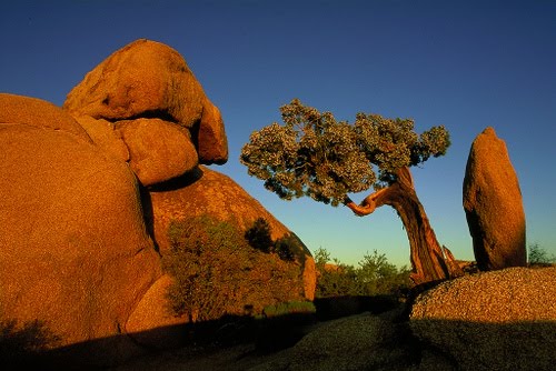
Joshua Tree National Park is located in southeastern California. Declared a U.S. National Park in 1994 when the U.S. Congress passed the California Desert Protection Act (Public Law 103-433), it had previously been a U.S.National Monument since 1936. It is named for the Joshua tree (Yucca brevifolia) forests native to the park. It covers a land area of 789,745 acres (319,598 ha). A large part of the park is designated to wilderness area—some 429,690 acres (173,890 ha). Straddling the San Bernardino County/Riverside County border, the park includes parts of two deserts, each an ecosystem whose characteristics are determined primarily by elevation: the higher Mojave Desert and lower Colorado Desert. The Little San Bernardino Mountains run through the southwest edge of the park.
This is No.15 of a series of articles on popular national parks in the US.